Vidden Trail without Fail (Bergen, Norway)
Bergen, Norway
The muddy, greenery and terrain made for an interesting time and was much better than the sceneries I saw in many of the dried-land, human-trampled dead grass videos of Vidden Trail, that I watched, prior. If you have A.D.H.D., or are just a classic stereotype, then you can just watch the video since you’re not likely going to read this.
Ever notice how much everyone talking out BERGEN, NORWAY, posts cute Instagram photos of streets and food and ‘cute’ things, but then you get turned off because who cares about that garbage that every since travel blogger is talking about all the damn time? They all post the same crap. Time to be advised about something different to do, when in Bergen, which you will not find in their travel guides because they’re not travelers, they’re only vacationers in these countries they go to. The place I’m talking about here, it’s right where all of these people go when they go to Bergen, you even see them post photos looking up intimidating, long stairways in their Bergen photos, but do they go UP? NO! They don’t and can’t go UP, they’re not fit enough to handle going up above Bergen, so you never see it in their blog entries. They don’t want to get dirt on their $500 outfits they bought for vacation and brand new sneakers. I hate these people, and I ended up being surrounded by many of such people, when I took a tour of Scandinavia. So I made a mental mark to get a look above Bergen, when we finally go there because I wanted something other than shopping and Instagram nonsense sightseeing. After doing so much touring of Denmark, sitting by vehicle, and way too much eating, it was time to go around and do some exercise for a change. While I did go almost/seemingly street to street in Copenhagen, Denmark, I really wanted to do one of the hikes I heard so much about, in Scandinavia, but the time in Denmark wasn’t going to allow for much in those few days where I was rushing about, hitting all the photo spots I wanted to rack up, while there. I did, however, plan to hit up a few hiking spots when I finally got to Norway, and the one I was really excited about was one that many non-Norwegians never even heard about, or if they did hear about it, they avoided it after locals probably talked them out of doing the hikes- more on that later. My target was a place in the town of Bergen, Norway, which is a beautiful town tucked just inside of the mountains and accessible by way of the beautiful fjords if you came in by boat, as I did. On the boat ride over, I asked a few people, who were on the same destination trip, if they wanted to do a little bit of hiking, and they initially all agreed. They asked me to send them some information on the hikes I proposed, and mostly everyone took to the second hike I had planned, which was not in Bergen and was just simple walking for 1hr or so. That one looked easy to do, and it was, so people agreed they would come with me to do the real hike I had planned, when we got to Bergen, the Vidden Trail. I sent these people a link I got from YouTube, of a couple of Indian guys who claim they did the train so easily that they claimed they did the train end to end, with a video where they were passing everyone easily. They sped the video up by like X 100 speed (I know why now), but when you watch the video, Vidden Trail looked rather flat, easy, and just about all kinds of ages and sexes of people were out on that trail. It looked so easy to do, so I thought it was a good exercise for all. I saw a really elderly woman in that video, and because I saw this, I invited the others to do the Vidden Trail with me. They saw those old ladies in that video and figured it couldn’t be that hard of a hike, so they agreed to meet me after we finished some morning activities. How hard could it be? We observed the footwear and gear of the people in the videos, they has running shoes on, mostly, not that many had actual hiking boots that went past the ankle, and normally, when you see this, you get a hint that the trail can’t be that difficult or they’d need better shoes for harsher conditions, right? I packed my very good Colombia boots just in case, because I don’t play with my ankles and knees, at this point in life. I’ve damn near destroyed both my ankles and my knees in Jiu Jitsu, MMA and Combat Sambo, throughout the years, and man do I feel it going DOWNHILL on rocky surfaces during hikes. Still, had to be a peace of cake to do Vidden Trail because of all those people making Vidden Trail seem so easy, so flat, so dry. Everyone was convinced how easy it was, and I showed people pictures from Google maps of whole groups of old people at various points they used as resting stops- although, I saw how purple and pink their faces were, and saw all of of them with their mouths open, likely gasping for air in the pics. Still, I didn’t want to say anything to not frighten anyone so they’d go with me. On this day of the hike, I had been out since 8am doing other activities outside of the immediate downtown of Bergen, so, I intended to hike after I got back from all of those activities, in the late afternoon. However, as the time wound down to do the Vidden Trail hike, people went to eat and then they got sleepy and I saw the circle getting smaller, some people didn’t bother to check in to the WhatsApp messages, and I saw what was happening, they were all going to bow out. One guy came to me and told me that something didn’t make sense about that Vidden Trail video that I showed them because he looked at AllTrails’ site, and another site, but those sites claimed Vidden Trail was not as easy as I made it sound, and certainly not as easy as the video was trying to convey from fake manly men. He was spotting some of the same elements that made me question those youtube videos too, along with the pictures I saw in Google maps that included the groups of people. When I saw that the rating was moderate, well that’s up for interpretation, so I ignored difficulty rating. That guy told me that ‘moderate’ is the rating given to Vidden Trail by experienced hikers who have done it, so it’s likely not for everyone. That was enough to discourage some people who were within an earshot of us, so they dropped off of the Vidden Trail mission.
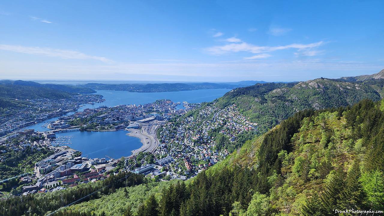
I ignored what the guy said because I thought they were all just trying to be lazy and that they would eventually wiggle out of the invite to get up on Vidden Trail, which they ALL did right before it was time to go. They said they wanted to go to Mount Fløyen, instead, which they said they would navigate up on by funicular (train), to the top of Mount Fløyen* (we’re going to examine what the ‘top” really means, later), which offered some really interesting views over the town of Bergen, and towards the fjords, but would involve no hiking at all, for them. As it turned out, the funicular ride up to that point on Mount Fløyen was a very popular tourist attraction, so, I agreed to check that out too, and we all went up it. These people thought the Vidden Trail was a hike you can do up Mount Fløyen and back down to center of town, but it turned out that the Vidden Trail is a trail that is made- and disappeared occasionally, between Mount Fløyen and a neighboring mountain called Mount Ulriken. Bergen has 7 mountains that people can hike across the upper north portion of the town, to traverse. Vidden Trail is a portion of that, it turned out, so it’s confusing when you see different sites and travelers talking about hiking it because when you check their pics, they’re taking pics from places I know for a fact were not on that Vidden Trail, they were on a different portion of hiking the 7 mountains. I only know this because I did Vidden Trail but I mapped out additional portions of the mountain ranges to explore, and some, I went to completely by mistake and had to turn around. Those other portions, especially those to the west, were very easy to navigate and were closest to town, so the elevation is much lower, although you won’t realistically get altitude sickness until you cross 8,000 ft (2500 m) above sea level, and these mountains were nowhere near that heigh, they’re like a fifth of that. In my mind, I thought, this was a piece of cake. Simple enough, all one would have to do is just walk between the two mountains advertised online and the Vidden Trail would be simple to accomplish. That guy who was telling me he didn’t think something was right about the trail was an experienced hiker, and he backed off with the quickness after doing some reading. All portions of the 7 mountain traversal are each rated moderate. I wasn’t phased but the others were, I wasn’t going to miss Vidden Trail. We went over the mapping of the Vidden Trail, and he told me that there was no way those Asians in the youtube video did that trail in the time they claimed, or they would have run out of camera battery (1-take), or hard drive space, WATER, from all that filming at 4k and what-have-you. He said you need at LEAST 4 hours on the Vidden Trail, and that’s if you’re an experienced person who has done that trail before thus you’d need much more time if you never did it, so he was out. I was just annoyed that they ALL backed out so I ignored him, went back down the Mount Fløyen funicular, cleaned up, collected my gear and hiking needs, and headed over to Mouth Ulriken, to start the Vidden Trail – although one can start the trail at Mount Fløyen and go to Mount Ulriken too, if they wished. The way I saw it, if experienced people would take 4 hours, then I’d need 5-6 hours because I was going to do some photography up there, and do my own version of video capture of the Vidden Trail, using my 360 camera and action camera as well. I won’t lie, it was irking me that there were so many conflicting opinions on how complicated Vidden Trail was, and I think it’s because people are rating the uphill effort, which these mountains aren’t that high to complicate much, but I would later learn what the real deal to it was. It was bothering me so much that it made me want to tackle it even more. I needed to see why that video, those other guys did, seemed so easy, and they were holding a camera phone the whole way without putting it down. HOW?
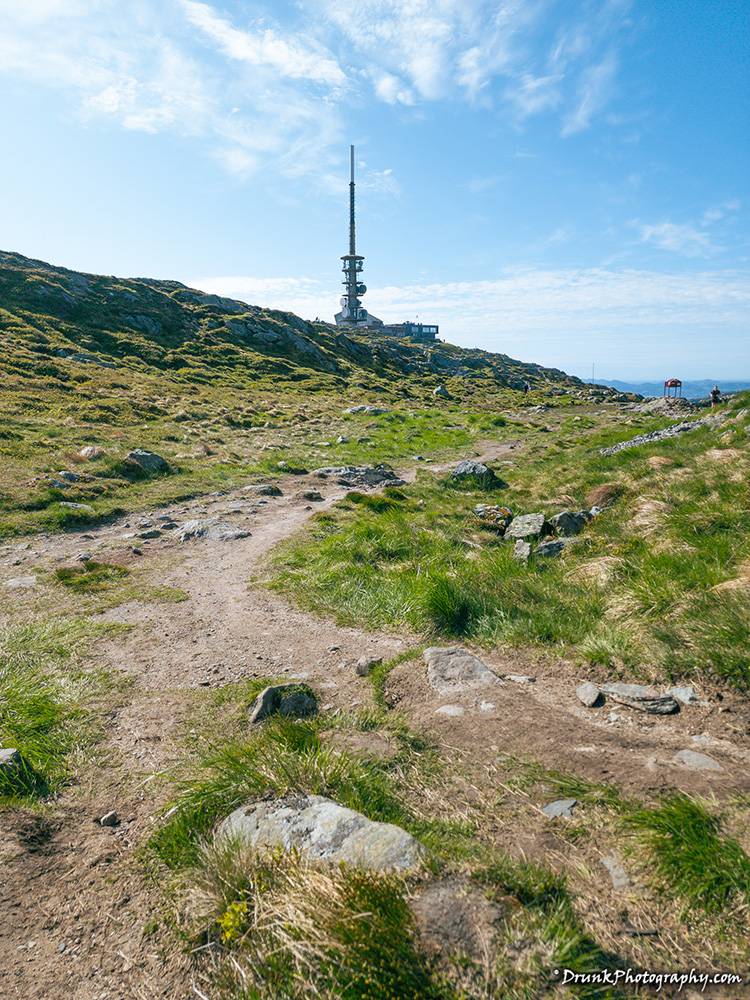
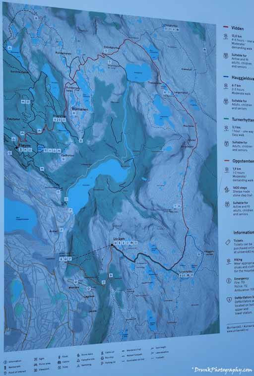
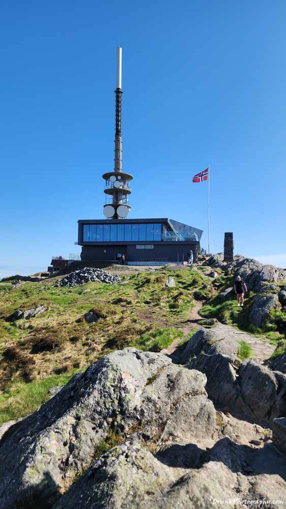
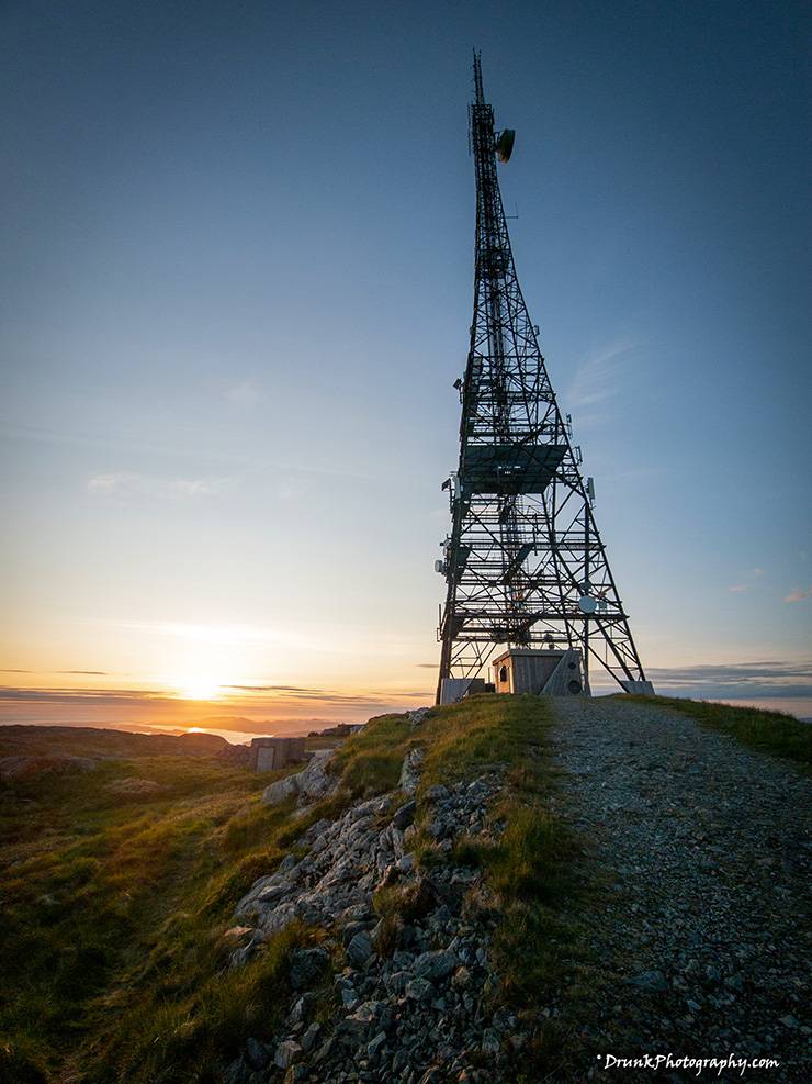
I wanted to time the walk to a point where I could likely end at a point where I would likely start to see the sun go down, so I did some research and found out that in Bergen, in May, that sun doesn’t go down until 11pm at night! On tops was a good thing because that allowed me to do a whole bunch of events at the top of the morning, and then at 5 or 6pm, start my hike of the Vidden Trail and catch sunset at the top of Mount Fløyen, where I figured I could just camp out until sunset came, do a little meditation up there while I watched the sun go down. I high tailed it to the Number 2 train, and took that to the base of Mouth Ulriken, where from there I could either walk up all the stairs to get to the top, or just take the cable car up, known as the Ulriksbanen or Ulriken643, which offered amazing views. Of course, for all the benefit, I took that cable car up, saving time and energy. When I got up to Mount Ulriken, to start the Vidden Trail, I saw a handful of people up there, all just crowding around the giant TV tower up there, but when I looked out on the plains, I didn’t see ANYONE going in the direction of the signs I saw that indicated where the Ulriken Trail was. I was up there for 30 minutes taking pictures at the top of the and saw NOBODY going on those trails heading towards the area I figured was Mount Fløyen, and I couldn’t figure out why that was, initially. People rode up, took photos at the touristy spot, then took the Ulriksbanen back down. In fact, if you buy a ticket, you must determine if you want a two-way or one-way ticket, when you are at the base, and I’m not sure you can buy a ticket to go back down- I mean I’m sure there is some way, but I figure the lady said you must make your choice at the base for a reason. I, of course, picked one-way (up), because there was no turning back. I was going to complete that Vidden Trail or die trying- and die trying I almost did 100 times over! Here is the course you’ll have to take if you go. You should also pay attention to the cautions that they have on that page, and related pages, because I had to assist another lady who was limping on the trail a little, to send her BACK, to a location where someone could come to assist her. She was debating going to find one of those call boxes where you can go call for emergency or something. I had some ibuprofen in my bag from an earlier trip to the pharmacy, on the way to Mount Ulriken, so I gave her one of those from the pack, and she waited for it to kick in before she took off. She had another 4-5Kms more to go to get to Mount Ulriken and she had plenty of time to get back down via the Ulriksbanen cable car, but I told her to go to the call box if she can’t make it. She was a trooper so no need to babysit her, or at least that’s what I tell myself so she could get out of my face and leave me to my quest. Go get a husband if you want help. I could see on the faces of people I passed to know that some of these people were fighting themselves, in their heads, trying to power through the rest of the trail- but they hadn’t even reached but the first 1/4th of the trail. When they took breaks, in front of me, I could see them heavy breathing and contemplating going back, because I could see them look behind them and then looking ahead to the possible goal. One guy even asked me how far and how the terrain was, and I of course lied to him, telling him it’s all easy from that point on, which technically it was if you end at Mount Ulriken, because the incline to it is not that noticeable. It’s going from Mount Ulriken west to Mount Rundemanen, where it is a strong uphill after multiple deceptive, seemingly flat runs. Weather seriously changes this course, dramatically, so if it’s too misty up there, you’re getting lost and it’s very easy to go the wrong direction. So prep as much as you can, if you’re a newbie to that area. I did prep and still was confused on much of that trail. It disappeared at several points, earlier on which got me lost, going EAST when I should have gone northwest.
GPS cut out on me in the eastern half of the course, that’s why you can look at my tracker and see it’s not as accurate as the western most part of the screenshot because that’s when the signals pick up better, thus it’s more detailed. The weirdness taking me to the southeast sharp line, in the graph, is because I went down the stairs that people use to climb up, to examine the view from there, which was also magical, but then I had to come BACK UP to the stop of mount Ulriken. The GPS was signal was not strong there, not even on my Insta360 GPS remote (watch) which did not get a signal in that area to the east. I watched some of my video back with overlay stats from the GPS remote and the stats suddenly cut out on the video, for that reason. This is why you’ll see it says I was doing something weird for 30 minutes in that area, that was me climbing back up the steps back to the stop of Mount Ulriken after taking pics of the first guy floating by parachuting. Many people told me that I did not do this trek, they simply refused to believe me, so, I ensured that tracking was on so I could produce something and there it is. I didn’t have a tracking watch but at least I had the phone, good enough. I just had to make sure I had enough battery power to keep the phone running because I’ve been trapped without GPS/Phone before because when your phone does not find signal, it eats up all of your battery trying to find signal. You’ll lose 1 percentage of battery power every minute and true to form, almost 1 hour and a half I was almost completely out of battery, because I wasn’t counting on that happening, so that also contributed to the inaccuracy of the east part of the graph. I had power packs with me, so luckily, they could charge fast enough, but I hovered at about 60% again when the signals were dropped entirely, again. So, keep a good power pack on you, that charges with solar, rugged, waterproof, has wireless charging and doubles as a flashlight/emergency light, like these here, which have 36,000+ mAh, so buy from that link. —–UPDATE: In 2025, the airlines are banning the transport of battery packs over 100Wh (100 Watt-hours), and they will take your battery away, so check your airline before you bring any battery packs and do your calculations. Your voltage x Ah (Amp hours) will determine the Wh. Read more, and use the calculator here or risk TSA and airline security taking your power pack away. If you have old batteries and the label is faded, DO NOT BRING THAT BATTERY PACK or they will take it from you and some worker there is going steal it for themselves! Some TSA agents are ignorant of how to calculate Wh, and YOU should be able to defend your battery pack from them. Seriously, they tried it with me last week! It better read on the side that it’s less than 100Wh. I personally recommend this Ugreen Power Bank here nowadays, buy it from this link and the math I told you works out which is 72Wh and passes checks (14.4v x 5Ah = 72Wh). At the bottom of the Amazon page you will see the official statement from Ugreen that it is TSA approved. Otherwise, risk authorities confiscating your $100USD+ power bank, and you don’t want to pay $200EURO for a battery pack in Europe with less capacity (happened to a buddy of mine recently). Don’t screw around for hikes like this. END TANGENT RANT— After all was said and done, between the phone and changing multiple batteries on my camera while filming or hiking, my power bank retained over half the power at that end of the 6 hours, which is amazing considering that I had 4 things changing at once, constantly, the whole time. I had a cable directly connected to my Insta360 One R in action camera, while charging spare Insta360 One RS vertical batteries directly, while charging the phone, and charging my Sony camera batteries in a USB charger. I knew it would weight me down but the payoff would be so much greater to be able to come back home and have 360 video of the infamous Vidden Trail. I was willing to deal with whatever pain would come after, and I had an active start to the day and another active day the day after. None of this matters when you put yourself in the mindset to set a challenge and smash it, and it helps to be a little ignorant about the task ahead so you can’t back out in case you are not strong enough to take that challenge. I must be wired differently because the more that did not make sense to me and seemed harder, it only made me more enthusiastic. I was losing too much time though, so I had to quickly boogey and find a quick way to get the Vidden Trail’s start. One of my new things to do is to try to travel to places like the local do, when I get to a location. I like to compare that to back home (NYC) and their setup is clearly superior, and advanced, but you pay on an honor system. You could just get on and not pay, and if there is no train employee going around checking you, then you can ride free- which I advise you against, especially if you’re Black. However, if you decide to take it to Vidden Trail, if you don’t have their app, you technically don’t have proof that you did pay unless you have the receipt, which is in their app. So you have to take a picture of that screen as proof, but when you scan the QR code on the screen of the payment machine, you get taken to page that does not get you anything if you don’t have their local app. Keep that in mind. Still, I advise you to not take a cab there (expensive), or drive there, get on the public train or the bus and take it under the hospital, to walk to Ulriksbanen (cable car) up to Mount Ulriken, to start the Vidden Trail. If you’re gangster and have time (I did not), keep heading up the past the pay center for the cable car and you will spot the stairs for walking up. That’s going to take you just under and hour to get to the top though, if you walk to get to Vidden Trail. When I got to the top of Mount Ulriken, via the Ulriksbanent, I saw people who were coming from the stairs go look around, hand for the 30 minutes I was up there chilling and fueling up, then I saw them queuing up to take the cablecar down.
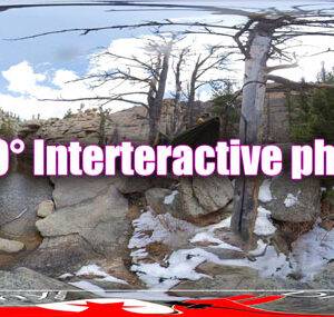
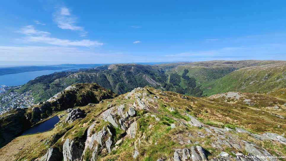
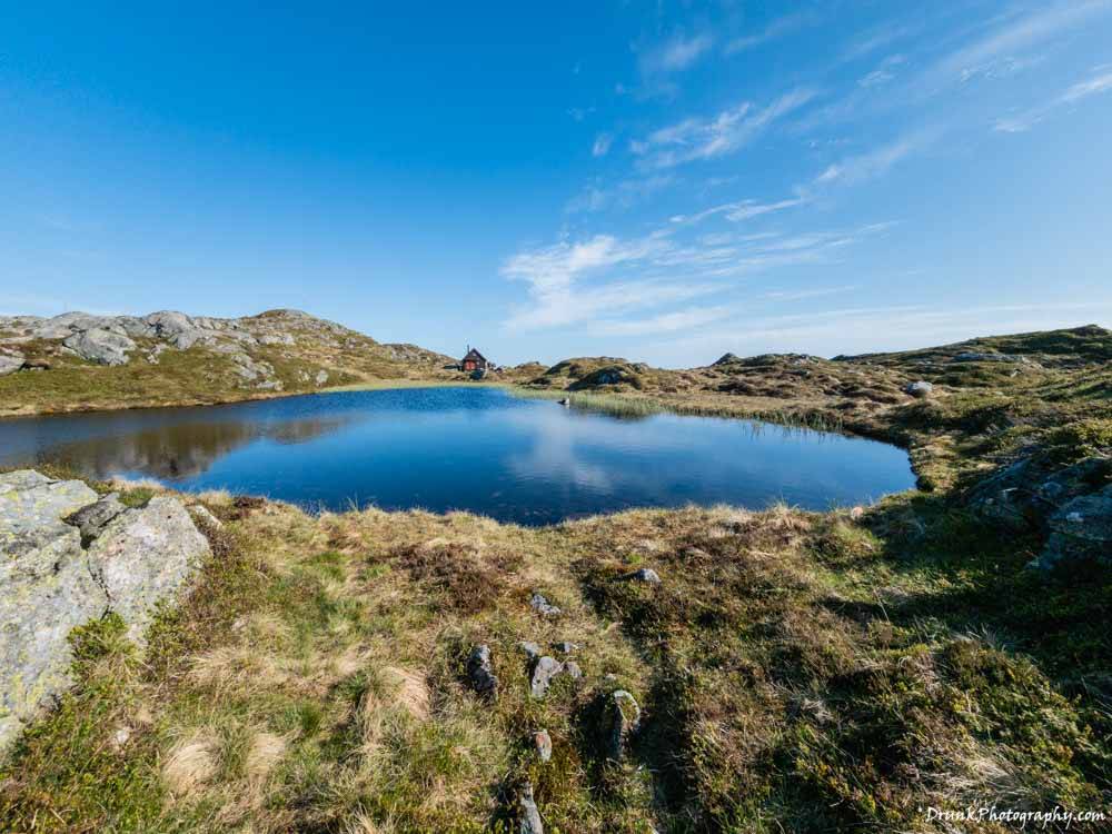
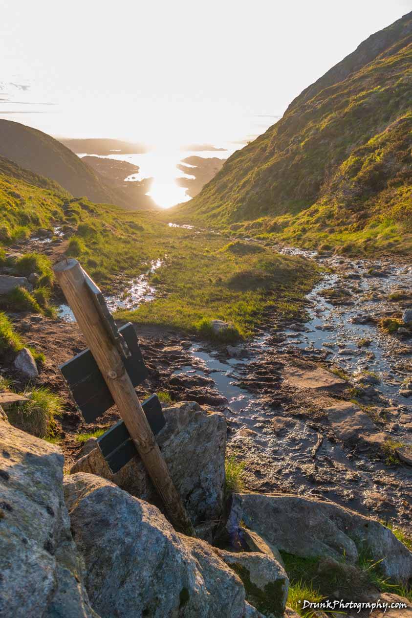
If you go up Mount Ulriken, you’ll see that you are at the highest mountain in the region of Bergen, which is the highest of the seven mountains they have up there, 2,110 feet above sea level, or 643 meters above sea level. Mount Ulriken was known for people dying up there, by suicide (historic times), and by accident in our recent times. Even that Ulriksbanen ride killed people in the 1960s, so it closed for more than a decade. You can definitely make the wrong turn and plunge to your death in a couple of places there, and THAT is what I learned when I did that trail in the direction that I did, which made me question that video as I started facing the obstacles, I saw up there, as a first-time navigator of the Vidden Trail. Just the name alone “Vidden” means like an expansive landscape, which means a lot of land to get lost in, or as I started seeing as I progressed, you’d sink to your waist in wet mud if you were not very careful where you are going. This can be very exciting or very dangerous, depending on your risk appetite, but I found myself knee-deep in mud, more than a few times, trying to find the right marker to get on the proper trail. The problem is, the trail will often disappear, and you’ll have to look out for markers in the form of iron poles planted, many times without signs, or piles of rocks sitting on multiple mini-mountain tops. So, no navigate, I figured that I couldn’t exactly get lost if I just kept my eyes open for those markers- which disappeared MANY times during the trail and this is where I spent most of my time, trying to figure out ways to the next marker, because for many stretches of the Vidden Trail, I SAW NOBODY AROUND FOR MILES AND MILES AND HOURS AND HOURS!!! I actually started off going in the wrong direction east and had to double back after 45 minutes the wrong way (East), because I followed a trail that was not the proper one. Google GPS was acting funky too there, so it was partially reliable- but when I ran out of stone markers I was tracking, I realized that I was going the wrong way and had to double back. I guess this is why the sites that talk about Vidden Trail tell you not to go unless you are familiar with the landscape? I should have known that since I didn’t see the “tourist”-looking people leave that immediate Ulriksbanen area at all, that they were too scared to navigate because the area immediately leading to the trail also has a few trials for you that can discourage one from continuing, including the mud sinking. If you didn’t have the proper shoes, you were going to be in for a ROUGH time because most of the Vidden Trail, that you can actually track properly, will involve navigating on top of ROCKS, small ones and big ones, which means your ankles and knees MUST be in very good condition, or you’re not going to make it! This was another clue that the video with the Indians making quick work of that trail was BS, they didn’t even have good shoes and would have busted their heads open slipping on that stuff. I have Columbia boots that are excellent, waterproof, and cover the ankles, but if you stepped in the cold muddy water, you could feel that temperature change- I had 2 layers of socks on too. Bergen is a very rainy area, so that area was extremely wet from melting snow and from rains, freezing rains, at that. If you touched that mud with regular sneakers, and the water went through, your toes wouldn’t survive the hike without some excruciating pain.
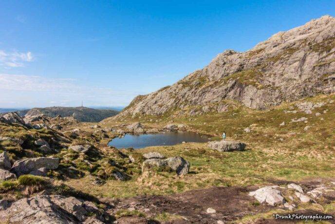
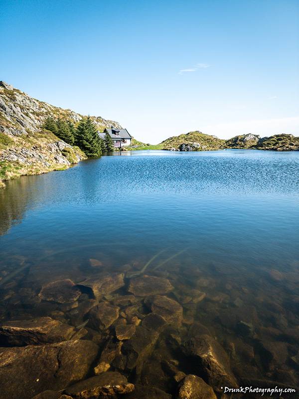
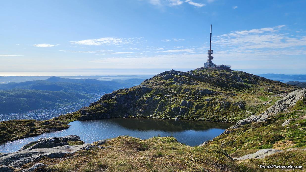
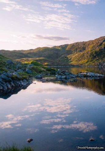
As I started the trail, I could see how someone would immediately turn right back around, it was just freezing up there at the top and you can’t SEE the end of the Vidden Trail anywhere. It looks like it is a never-ending landscape, and if you go the wrong way, it surely is! I saw a few people who were not dressed appropriately for the hike, going down the stairs to get to the bottom of the mountain, and it looked like they thought about doing that hike because they were asking something in the Norwegian language and pointing in the direction of the trails in the distance, then the dude looked to his woman and she tucked her arms like “hell no”, as she started heading to the stairs to go back down to the base of the mountain, the long way. LOL That lady in the picture above thought twice after seeing it took her up to 10 minutes to get to that pond, which was 5 minutes walk for me. She got on the rock, looked to the right (trail entry) and did not bother! She went back to her group with their tickets to go back down the cable car. Her people scanned the barcodes of their tickets to get back to the Ulriksbanen, so that meant they bought two-way tickets to get back down and only came up to see the view. While the Ulriken Mountain is the tallest mountain, it’s not the well-known mountain to take a tram/cable car up to see the best views from. Everyone only knows Mount Fløyen as it’s the one that is in all the adverts and the funicular up is modernized. The Mount Ulriken Ulriksbanen stop running many years because it couldn’t get the proper funding to stay in business, which means it needs a serious Press Release makeover because it seriously is NOT the view to miss, and it stays open until 11pm so it’s PERFECT for sunsets. There were not more than 10 people up there on Mount Ulriken, when I went; meanwhile, Mount Fløyen had at least 100 people up there. You have to be seriously careful on the rock cliffs of Mount Ulriken though, it’s easy to die with 1 slip on those slippery rocks. Since I didn’t see anyone ready to do the trek, I just ditched the crowd and started the Vidden Trail, praying I could make it to Mount Fløyen by sunset. It was 6:30 by this point, and thankfully the sunset was 11pm, as I knew, which would allow time for me to photograph the scenery and not just figure out how to navigate. I tightened my boots, once more, after a near slip off a clip, which was my first glimpse of how dangerous it could be if I didn’t take it seriously, going up there as a novice to the area and not strapped right. Oh- did I mention I had like 30lbs of camera/video gear, batteries, coat, head gear, multiple water bottles, etc? OH, tip for you, if you go, you MUST have at least 40 ounces of water because it’s very easy to dehydrate up there. I was constantly drinking water and even still got a little lightheaded in a few places, mostly because my bag was starting to weigh on my neck, I realized, after hour 4 of climbing mini mountains as part of the trail. When you look at several maps, it looks entirely too easy to navigate, and a start to finish guide is found here. I looked at at least 10 version of maps of the Vidden Trail, and almost no two of the maps looked equal. Maps were saying the course was 7 to 10 miles (11 to 16 km). Why did they vary so widely? Those extra miles and kms mean a LOT. I can tell you it’s closer to 10miles / 16kilometers because, after a while of walking, you’ll see a sign pointing to your destination and that sign has 7km+ to the destination. It’s equivalent to why you shave down to the base of your Johnson (aka the ‘optical inch’), those extra metrics means a lot optically! 🤣 Just like that can make someone give up on you, based on those metrics not measuring up, the same is for the hike not being the length it claims to be. PAUSE. ✋🏽 I just had so much conflicting information, which is why I tried to only show the easiest stuff to the people I tried to get to come with me. I am so happy that nobody came with me up there, I would have felt so bad if they did come with me because they wouldn’t have made it and we’d be up in Vidden Trail for over 12 hours! I mean I saw the people turn back when I was at the start of Vidden Trail from Mount Ulriken. They went to the first major obstacle, went to that top marker for the trail, and came back. I know because I saw the group when I first got off the Ulriksbanen, going on the trail and by the time I was ready to star it myself, I saw them coming back! They gave up and they weren’t even dressed appropriately for Vidden Trail. The people I tried to convince, they would NEVER have let me live it up if they came with me, and likely would have turned back around just like those people I saw. I even saw one lady with a kid who couldn’t have been more than 5 years old, NO WAY they did that whole trail coming the opposite way that I was going, hell now. Those people were people turning back, had no sweat on them, didn’t have a coat or anything, didn’t have mud all over their sneakers, no goddam way they did that trail and that gave me the initial doubts about what I was getting into – it did not deter me, I just wanted to know the real length so I could know that I would be in position for the sunset photography I wanted to take.
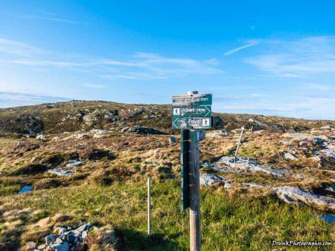
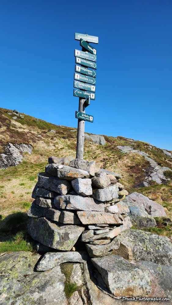
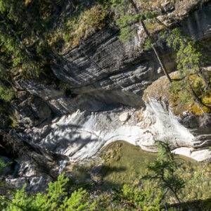
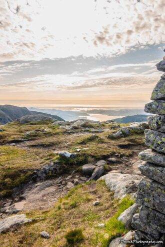
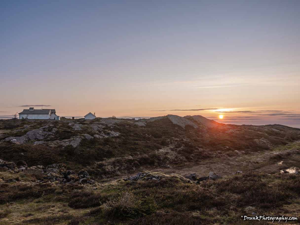
Man, if you have the guts to do this, and you like taking pictures of mountains and ranges, this is certainly your hike. I found myself staring off into mountains, wishing I could walk further into them, as the time went on, but knew I couldn’t go to everything I wanted to see, even if it was way off the trail. I went off the trail many times, sometimes by mistake, but often because I wanted to get closer to something I wanted to photograph, like some cabins or houses or something that were stuck right in the middle of seemingly nowhere! Sitting right on cliffs, or just on top of mountain side, you’ll see some house/cabin that was seemingly abandoned, and when you look around, you will see that there ARE NO ROADS to take cars or bikes up there. I began to realize that whoever lived up there, or rented those cabins, they have to hike there every time they wanted to visit it. When you’re on the Vidden Trail, there are no roads! You must go on foot, there is no bypassing it. Some of the structures I saw were red houses or cabins, and they had some text on them that indicated that they were emergency shelters, or something, but I didn’t see a call box, so I’m not sure what they were for. I can tell you this, if you get stuck out there, there is no lighting there. There is no artificial lighting, there are no electricity poles, there is NOTHING up there but you and ambient light from God! If you do this Vidden Trail when the days are shorter, you’re in for a world of mess if you did like I did and start late. If you don’t know that trail by heart, you’re spending the night up there, or maybe you get to one of those red cabins and make a cell phone call if your reception comes in, then read to them the name of the station? I figure that’s how that works, anyway. I surely wasn’t going to find out though. What’s funny is that when I did start to see people, I was starting to head into hour 5 and hadn’t seen anyone since my start to the Vidden Trail, which at first was a little odd of a feeling, I’ll not lie. Why? Because when I started to see people, they were NOT going in the direction of the Vidden Trail that I was going in. They were going the opposite direction that I was going on, and most of those people looked like locals, most going in a small group of up to 3 people, and if I did see someone by himself/herself, it was someone training really hard and they were flying by me, because clearly they knew the trail well and knew many obstacles to avoid there, because they’d find ways around that saved them a lot of time, which was not exactly where the paths would indicate that one should step, especially with the mud issue I told you about, which you might sink to your death or something. When I saw people, I was just past what I figured was the halfway mark, because I could see a different type of tower on top of some mountain, in the distance. By this time, I finally saw a sign telling me that I had just around 7km (~5 miles) more to go, and the entire Vidden Trail is +15km (~10 miles), if just looking from a FLAT perspective, yeah it would be 8 miles / 13km, except you’re going up and down a lot and around things, especially where it was flooded with water and I couldn’t go straight a lot, in my case. The thing about that distance though… it’s not a straight line!!! It’s a roundabout looping of the terrain that makes up the Vidden Trail, so you think you can walk a straight line when you look from mountain top to another, but you’ll find you are sadly mistaken. In fact, what they do not tell you on some maps is that you’re not just hiking from Mount Ulriken to Mount Fløyen, and I had to look this up because I thought I was going to wrong way. You’re making to ANOTHER mountain, Mount Rundemanen before you come up on Mount Fløyen, which is one of those seven mountains in Bergen. You’re going down into valleys then right back up to top of mountains, while you wind and loop too, the whole trail through! So while it is officially 15 kms, you’re going to work that whole 15 km! When I was trying to keep my bearings, I was tracking the radio towers on the top of the mountains, to know which direction I was going, so that if I lost too much light too quickly, I could head for the towers and know I was going in the right direction. So the real marker was 15 km or 10 miles that’s the official length, from the site runners of main tourist site for Bergen and they have no reason to lie. It’s also accurate because a quarter of the length of the Vidden Trail is from the north-most part of the Vidden Trail into town. Just math wise, that is not even half of the trek, and I knew this thing couldn’t be 11kms in total. 11 kms is from Ulriken to the Radio tower.
However, at the start of the hike from Ulriken, a “hiker” told me that the Vidden Trail is TV tower (Mount Ulriken) to Radio Tower (an unmentioned mountain name in all of the hiking guides) basically, so keep my eyes on the towers, which is not exactly true I found out, after I got up to the radio tower, because Google Maps was accurate then, and I realized that was not Mount Fløyen, that was Mount Rundemanen’s Radio Tower. That name was not on any hiking guides as part of the path and that would alter a LOT after I realized this. Mount Fløyen doesn’t have a radio tower! 😒 That means you’ll be going up and down multiple times, during this hike, you’re not going downhill from Ulriken to the lower mountains directly, there are many peaks and valleys to conquer and Mount Rundemanen’s height is 568 meters above sea level (1865 feet above sea level). However, that was the tower that I wanted to make it up to for sunset, so I started to pace myself because I could see that if I got up there, it was almost downhill from there, through some valley that looked like it would get some sick views with the sunset, although you’d lose light. I saw goats coming up to check me out, and they had bells on their necks, so someone owns them, but that’s how I knew I was getting closer to them, and that maybe someone’s farm was near, which meant I was GOING THE WRONG WAY! 😒 This is the tricky part, you can end up going the wrong way and you will see many locals avoiding some of these other mountains but the train seems to point you in the path to these harder treks, which is why the local people will go flying by you, they know the quickest paths and avoid the hard things like climbing up some of the mountains to get back on a path. You’ll look around and see a local, then they completely disappear, and you can’t find them again! Keep that in mind if you go there because it’s easy to take the harder path and you won’t even realize until your legs hurt like hell. You should track some of those locals who are coming your direction, or the few who go from Ulriken to Mount Fløyen and see which path they took and what they avoided. This is often how I found the trail, and despite the sites saying it’s well marked, that “well marked” is up for interpretation because it’s not so well marked when you look like you’re on a path that others walked and realized you’re doing another trail by mistake. That’s why the main site will tell you that if you didn’t prep for that hike, you’re likely going to take 7-8 hours because all those loose rocks or tiny rocks you need to step on, will hurt your feet, ankles and knees if you don’t have good shoes, meaning you’ll need to go much slower and they don’t recommend you do this hike in the fall through spring, because light is lost entirely too quick when it’s not summer time, plus the Bergen weather is not easy to track. You can get up there and if it’s cloudy, you can’t see very well up there, and surely can’t see the town. When I realized that the sun came through big time that day, it was around 4pm, and I knew it was the best day to try this trek, so I started heading to the train station to save time, so I could cable car up and get busy. I had already read that if you want to do Vidden Trail and want to include that walk up the stairs, you need to add an additional hour. I’m a little upset that I started to late, but I NEEDED to start late because I had the plan to try to still be up there to get a sunset photo or two from up in those mountains because the high points were where I was, and the lower part of town was where the sun would be setting. Since it’s Spring to Summer, that means the sun sets really late- although it still eventually sets, so, you have to get your butt to a location close to town that you can navigate in the dark when it does go down, and that did happen to me at the last leg of the hike. So, I did identify some of the places that that youtube video I watched (prior) showed, which was a mainly flat range, but there were many flooded areas that made the path difficult to spot in many places. The land was not dry like I saw, there were not many people up there, I was alone for HOURS and I was trying to get the full workout plus get some photos and videos going. If you go up there and want to do photography, you’re going to have to walk in some questionably unstable areas, especially when it’s flooded. I had to soft-step many times to test the ground first, before I firmly moved forward. I also climbed up or climbed down many mountains because when I tried to side step the mountains that had the markers, the snow that melted from on top of the hills and mounts all flooded the BASES of those humps. Circumventing the rocks and mountains would be easy but not during the conditions I faced. That video I watched had very dry land and that’s why a lot of people were out there and many people could move at the same time spread out, across the Vidden Trail course. This time, it was pretty clear that one must stay on the path. Also, there are people who thought you could photograph the Bergen town from many places along Vidden Trail and that’s not true. You move too far north up on the mountains, and at a point, you cannot see Bergen’s town until you see a valley between mountains. So, I kept and eye out for these valleys so I could get some interesting shots involving the sun and or the moon!
The site for the Vidden Trail also doesn’t go into detail about what you will find up there, and many things you see even on Google Maps isn’t all that well laid out, because you’ll go where someone marked a photo with GPS and realize that photo is NOT showing you what is really at that point. So, you have to be careful using Google Maps for some of your trek of the Vidden Trail. As you get closer to Bergen, you’ll see that things are more accurate, but when you’re at the halfway mark of Vidden trail, those Google Maps photos can’t be trusted because it is user submitted material. If you typed the Vidden Trail into Google Maps, you’ll only see “start”, you’ll not see the course outline. That’s why you can’t exactly count on Google Maps, which I did at the start and went 45 minutes in the wrong direction. You have to seek the markers for the trail out, that’s your best bet, when you’re too far north on Vidden Trail. As you get closer to Bergen that part of the trail will be better marked, but before you can get there, you have to hike up to the top of Mount Rundemanen! This is after I passed hour 5, coming up on hour 6, so my legs were really starting to feel it because you have to do a bunch of zig zags, hike up then DOWN some smaller mountains, prior to hiking all the way up Mount Rundemanen. When I got to Mount Rundemanen, I heard some people behind me, before I hiked to the stop of it, but almost 1 hour later, I finally saw those people make it up the mountain, as I was leaving after having taken all the photos I needed for the location. I began to see why people were going in the opposite direction than I was going, because you really don’t want to be in hour 4-6 going the direction I went, unless you’re training seriously, then have to trek up Mount Rundemanen at that point? Hell no! The people I saw going in the direction I was going; they were definitely all experienced and nobody was a tourist going that fast like they’ve done that trek since kids. They were flying by me, very serious, breathing heavily, sprint-jogging while I was huffing and puffing, finishing off the last of my water. When you see this, you start to question if you have what it takes to pull this off. Mind you, it’s at an altitude some people just are not used to, as well, and cold, so maybe this kept some of the other tourists from daring too, but the temp dropped quickly the minute the sun was not directly overhead. I also most of the people only with a water bottle on them, if they carried anything. They were use it for workout and weren’t out wasting time like me, but I could see many of them clearly avoiding some of the harder portions of the trek, and then when I noticed the shoes that some of these people were wearing, it looked like regular tennis shoes for some of them, not hiking boots. I think I saw a pair of shoes that I’ve seen advertised online, that are waterproof, but I can’t imagine the tractions was good. So, when I examined the paths those people were taking, they were skipping the rocks a lot, BUT they were cutting through the mud or finding level group that was dry, which I didn’t see a lot of earlier in the trek. Not knowing the trail well caused me more grief than required, but if I had to do it all again, I’d do the trek exactly as I did it, because I got a serious full body workout. A couple of the people have me the “thumbs up” when they saw me, so they were rooting for me, and clearly could see I was not a Norwegian. I think they were very surprised that I made it that far, and clearly had to have begun in Ulriken by the time they saw me, so I could see they gave props to me for doing that- plus with the backpack and the 360 coming out of it on the selfie stick, kind of gave me away that I was a madman out there. A couple of them questioned me about what that was, and I was just happy to have seen other people so I knew I was going the right way. lol I really felt the accomplishment starting to sink in, although I was apparently no where close to the end yet. LOL That kept making me mad, thinking I was going down hill so I was thinking I was coming to the end of Vidden Trail- NOPE. 🤣 If you look at google maps, they claim the Vidden Trail ended where I thought it did, but that’s not true because you’re supposed to go from Mount Ulriken back to Bergen downtown via Mount Fløyen. That’s when I started to bug out because I started to see the signs and Vidden Trail was not supposed to end where Google said. 🤦🏾
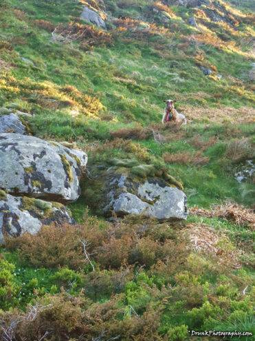
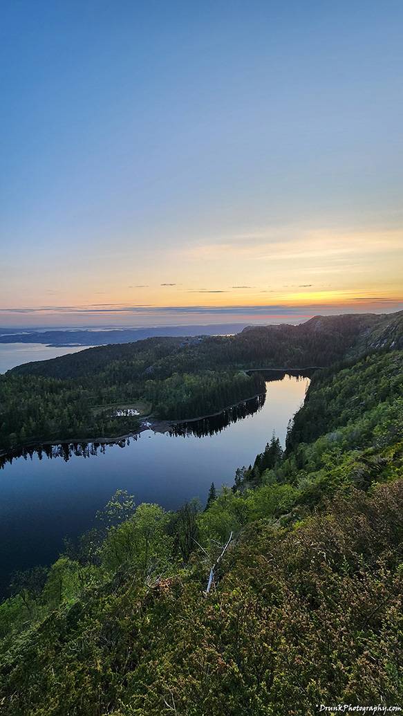
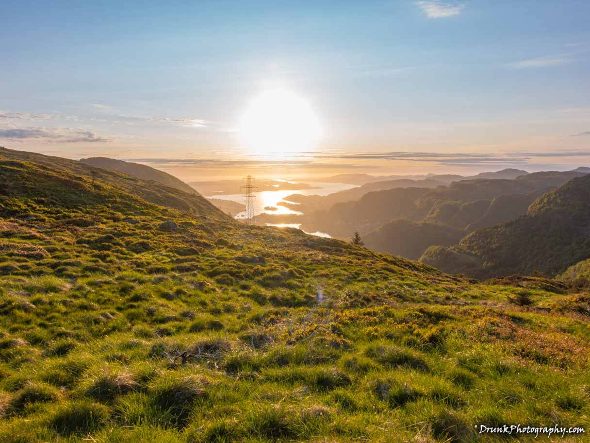
I never fully doubted that I could get that far, do all the things I did, and still beat sunset, but I definitely realized in a couple of places that I was going the wrong way because there was one point where I was face to face with a hovering goat, but it had a bell around its neck, meaning it belonged to someone in the area. I couldn’t see anything but a few house-like structures in the distance, so I figured the goat was from another farm nearby, and like before, I was probably going the wrong way again. It followed me for a little bit, at a higher elevation to keep track of me, to make sure I wasn’t dangerous, but then I noticed it walking back toward the houses area and realized I need to go the opposite direction because there were no farms in the direction towards town. I did notice some houses in the upper north west on the google map so that gave it away that I screwed up again and went too far the wrong way. After hitting a few mountains, before getting close to Mount Rundemanen, I had to go down into a valley and that’s when I saw the markers again and my hope picked up again that I could finish in time. It was a constant battle with myself, as I was starting to get severely thirsty again, and that air was very dry so I could feel my noise dry with a slight pain, this is what was giving the slight headache feel, my nose was hurting and I wasn’t exactly registering it properly with the adrenaline highs I was on. I could see in the distance though, that I still had a LONG way to go. When you get down into that valley area before town, you can get a glimpse of building from town, so I knew the direction that I had to go, but it looked so damn far away still. To make matters worse, as I took my last breaths to suck up the fact that I had no more water and my knees were giving out, I looked at that damn mountain that I saw gravel path for, which was Mount Rundemanen. So to get to town, I’d have to now hike to the top of that mountain, which was 568 metres (1,864 ft) in height, and then come down from there to get to town. But I was down in the valley looking up and that meant that it would require another 1 hour and 30 minutes to get from Mount Rundemanen to down, so that means 30+ minutes to get to the top of that mountain. Man, your mental has to be RIGHT to handle that! I thought this was all going to be downhill into down, once I hit the valley, but there was no path down, only up. As I looked up, I could see that there was that radio tower I kept seeing far out in the distance, so finally I saw it in my sights and I knew it was surely going to be a sweet spot. That view I would see is what made me hustle hard to get up the hill, the opportunity to an extremely beautiful view and photo, it was ON! I hit the high step and get my but up that hill. I get to the top of the hill and as soon at I pulled up under the radio tower, I came over the side of it and that sunset blasted me in the face, as it was setting off in the distance. The problem was that I was also seeing the moon come in in the opposite direction, and knew I had to hot step it quickly because there were no artificial lights up in that area, only lights from the city below and the ambient light from nature, and I did NOT want to be up there lost in darkness. I was in total amazement of the video I took from the Mount Rundemanen radio tower, it was magical to have hiked all that way, with the gear on my back like a moron, but it was all so very much worth it to be there, all alone, and prove that I really did it because I took the pictures and had video of me doing exactly that. With all the picture taking and stopping and going in the wrong direction, I did make it at just over 6 hours, so with good shoes and a good supply of water (e.g., water pack for backpack), it can agree that it is a moderate level of hiking, but it should be avoided if your knees are bad. The downhill is going to kill you worse than anything uphill., especially because you will have to step on rocks to get yourself down from some of those mountains. If you’re not climbing up mountains in some areas, you’re climbing down there, or stepping down them, and that’s going to murder you if your shoes and knees suck.
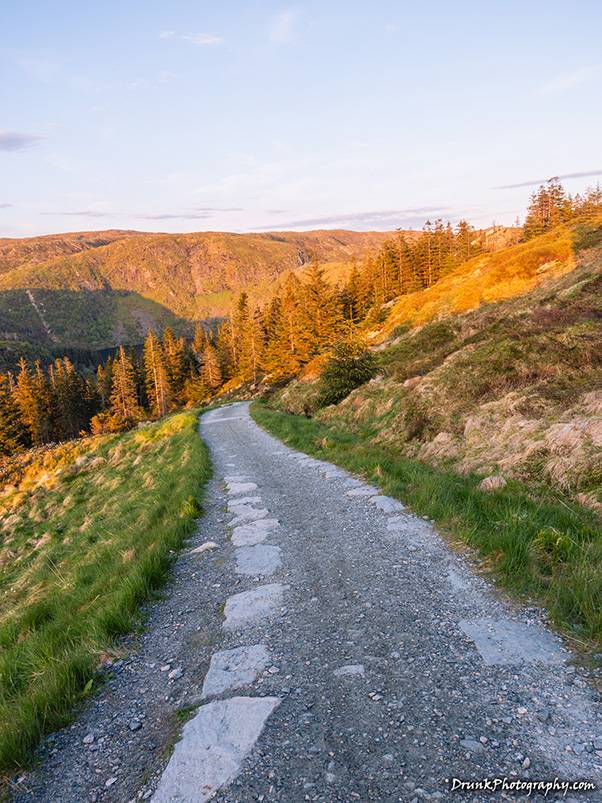
I was walking funny for 2 days straight because of that; my legs were shaking uncontrollably many times. I was so happy to make it to Mount Rundemanen because it was then easy to get to Mount Fløyen because it was just a downhill navigation from there. I started to pick up the pace because I remembered that that Mount Fløyen funicular stopped running at 11pm, and I wasn’t going to make it to the damn thing if I didn’t pick up the pace. My butt cheeks were on FIRE at hour 6 but I had to make it to that funicular. I’ll have you know, I did NOT make it in time to the funicular, and that meant I then had to walk along the roads they have there, for another 45 minutes, back to the hotel. 🤦 The only way down from Mount Fløyen at that point is to walk the path for the cars, on hard concrete, and that is when my knees started giving out, because it’s pretty steep and you have some hairpin turns to navigate on foot. Luckily, when you get down to the bottom, you pass an area that is known for pretty, old-school houses, in this one street along the base of Mount Fløyen. I got to see it at nighttime and got to see a pretty cool view of Bergen, at night. I stopped at a cliff to look over the town and night, and then some goats found me and came towards me. I didn’t want them to get made then charge and knock me off the cliff, so I directed them 1 way and then juked them to go a different direction so I could get around and get back on the road. When I got back to the hotel, I checked my boogers that built up, a had a hint of dried blood in them. My body dried out bad, I clearly was dehydrated but luckily, I had made it more than 3/4ths of the way before all that kicked in. I checked my feet, I had an under-the-skin blister on the right big toe too, despite having great socks and everything. This was all worth it, very much so, because that was an amazing experience and one of my best hikes to date, considering. When I checked that last leg that of Vidden Trail I didn’t know was going to be so complicated and didn’t know that Mount Rundemanen was between Mount Ulriken and Mount Fløyen. I saw that the little bit of push I made to get up the last mountain was a mini trail itself was rated as moderate also. Vidden Trail traverses a few of those 7 mountains that Bergen has, and I didn’t realize that, at the time, because all I saw in the youtube vids was flat land, as I said. That last leg from the mountain to down was 5 miles (8km) and it wasn’t 1 hour and a half average, it was 2 hours and 40+ minutes. I made in 1 hours and half though, because I was rushing quickly to beat the light. Oh, and it was 38 degrees (3C) up there, at the time. 🥶
That was a very magical hike, I got back to the hotel, soaked in a bath with Epson salt, and let my body turn into a prune, under that hot water. My body was DONE! I started to read some text messages and missed messages while I was on that hike, from people who were looking for me. Apparently, none of them believed that I could do the hike, since I wasn’t Norwegian. Even the hotel clerks couldn’t believe it and wanted to see pictures, because they saw my backpack and didn’t think I could make it the whole way while I was carrying what I had in the backpack, and the fact that I was up there for the first time, without a guide. Even the trip organizer did not believe me, and asked me a tricky question to ask how long it took me, suggesting “45 minutes or so?” She knew damn well that was not 45 minutes, and actually warned me against doing it too, initially, but she was trying to catch me in a lie. She even suggested I may have taken a trolley or something up to one part, in one statement she made that says that you can get through the path with a vehicle, and that’s Mount Fløyen portion, but that’s not where I was taking the pictures from. When she saw the views I took, she asked “did YOU take those pictures?” 😒 Nobody believed that I did this trek, because they all read about it and chickened out- rightfully so too, because not ONE of them would have made it, even that experienced hiker who backed off. One guy told me that the locals told him to not try it unless he is experienced. His knees would have given out. This is what made this Vidden Trail hike that much more special to me, because I know people looked at me and thought “oh, this is just some city boy”, as a couple of people made comments about asking if I even liked scenery like the fjords, and mountains. They thought I just liked looking sky scrapers and strippers, I guess. Unfortunately, when people hear that you’re from NYC, and you’re looking like I do, which is not someone they’re used to seeing, they think you’re only used to ghetto things they see in rap videos and European descendants’ portrayals of Blacks and Latinos. For sure, on the trails, I looked out of place compared to the other hikers, but I had all the right gear, and properly planned for that hike, so I am experienced enough to know how NOT TO FAIL. The only problem I had, was that I was expecting to see as many people as I saw in the videos I saw online, out on the trails. I maybe saw 1-3 people every hour or two! This made me really nervous at one point because Vidden Trail is a course but the land up there is all over the place and you can easily head too far north and be nowhere near the center of Bergen. There were almost no barriers in any direction I looked, it was getting freaky when I didn’t see the markers but I saw what looked like paths that were conflicting with each other. Some of these paths looked like they criss crossed each other, but what I realized later, after reviewing my video, I noticed that it was just weathered terrain that other people walked, which was NOT part of the Vidden Trail. This happened to me a lot, and that is a frightening thing when you start to lose light. You know what else was screwing me up? I saw so much beauty all over, I just kept walking to areas that I now know were not on the trail, because I mapped them in Google and notices I went too far north east, and then too far north, so I had to get back to the paths- but how? I started to see other people, and when I saw them, I realized that I at least going the right way. I also kept track of the sun’s movement, and I used the PhotoPills app to track the trajectory of the sun/moon, so I knew where I would need to be ultimately, because the sunset was going to be flying over the town. The problem with being up too far on Ulriken and that expanse is you can’t see anything for miles but mountain range! So, when my GPS went out, even on my remote, I started to feel away because by this point, the sun was directly above my head initially. I had no idea what direction I was going to go in. That’s why PhotoPills came in handy, to map where the sun would be at a given time, and I pieced this together because I had planned that trip so it maps and stores that data and gives you and Alternate Reality virtual look using your camera. Drastic times calls for drastic measures. When I finally rejoined the proper trail, by spotting people out about a mile or so coming down one of the mountains, I started to walk towards them and started to notice that I could see the rock pile markers again. More importantly, I was keeping pace with the sun’s trajectory as I went across the mountain range, and right as the app showed me, the sun was EXACTLY where the app said it would be over Vidden Trail! At that point, I just had to pick up the pace where I needed to get to a good location for filming and pictures. Using the mountains, I went off the paths a lot to get to the vantage points so I could see where it would be good to snipe from- which led to me sinking in mud, a LOT, off of the paths.

The next day, I posted some pictures of the hike to my group chat, and people still claimed I stole those photos from the Internet, so I had to produce the 360 videos of myself doing the walking for 5 kilometers before I even saw another person around! That shut most of them up and got some cool points from others. It also made some other people scared to do a second, smaller hike with me, in another town that we went to, which was 2 days after that Bergen hike. I was a machine out there, and I was determined to push myself to the limit on this recent trip, although I couldn’t convince the others to do so. The Vidden Trail is certainly not for the faint of heart, but I will tell you, if you have a chick with you, who is down, there are some truly magical, romantic views up there and they will be memorable if it’s just you two for a few hours alone- chica-womb chica-womb (cue the 70s Pr0n music). I’ll warning you, about the wrong chick you should not take with you, unless you’re really alpha and in shape; otherwise, your ego will take massive hits from her constant emasculation. When reviewing the video I made, I notice I forgot to turn off my Insta360 action cam, which I had with a strap around my neck, so it recorded our interaction. When I was coming down from the hike, I met a “sista” at Mount Fløyen, who was struggling to get up that little start, so I engaged her in talk to be helpful. It was like a 2 deer looking at each other like the other were headlights of a semi-truck. We paused at some distance, inspected each other, and realized “oh, shoot, that’s a Black”. 🤣 If you’re not Black, you don’t know what this is, but try to follow along, please. I was finishing my Vidden Trail hike coming down from Mount Rundemanen, going to Mount Fløyen and she was just starting, but there was maybe only about 30 minutes left of sunlight and I was praying she wasn’t about to do that hike the other direction I came from. No way! She looked like she was by herself at first, coming around the bend of the winding roads downward and she was the only person I had seen for about 1 hour at that point. She looked American, or Americanized, cleaned up, very well spoken, hair straightened not wearing weave, clear dark skinned chocolate chick with sexy legs (no booty), which was immediately telling of a woman from the Americas, either ADOS Black or Caribbean for sure. She was hot, so, of course I had to shoot my shot in a scenery like this, otherwise that’s same-sex energy. 🤣 It was way too romantic, the skylight was with the sunset orange and tint of purple-blue coming (she called it ‘mauve’) in, taking the rest of the sky over, it was magical and would make for an amazing origin story to tell her girlfriends if I could pull it off, especially with us being Black. Fellas, if you find yourself in these movie-like, romance novel-like scenarios, if you don’t shoot your shot, whether or not you want it, you’re a loser! If a man gets his advance shot down in the woods, and nobody heard it, did it happen? NO! This one though, I wanted, hell yeah I wanted it, conditions were too right, I’m not going to lie to you. I told her “I hope you didn’t plan to do the hike to Mount Ulriken, from here, at this hour, that’s madness! There is no ambient light past this point we are standing and sunset is here now!” as I pointed to the sunset, highlighting the tones changing in the sky to her and how pretty is was – in case she didn’t notice the photographic change in the sky- which she didn’t, at first! You gotta use PHOTO HIKING GAME, fellas, yall street game doesn’t work in the mountains, DayKwan! I knew it was partially working* because she was looking me up and down, with intensity at this point as we introduced ourselves and she was inspecting my camera gear attached to my bag and such. A couple of people told me that there was nothing worth photographing up there, other than the view of the town, WRONG! She said she was just exploring to see where the path was going, nothing spectacular was planned. She stared hard at me but not in a defensive or fearful manner, but a very inquisitive manner, and was doing speed-dating type rapid fire questions to inquire about me, which was very weird. She was definitely socially awkward, and it started to turn me off, the more she spoke, because she couldn’t help but lead her fake alpha female traits that are not feminine, as I kept seeing her look back. Now, it was DARK behind where she came from, because she emerged from behind where the mountain turned to forest. There were some people down there, also coming up, I could see. I told her I did the hike of the Vidden Trail so I started at Mount Ulriken and ended there and that she should try it, with a guide, or her buddies. She told me that her party wouldn’t be up to it and certainly now who she “came with”. Now, she looked hard behind her, posing like she was annoyed, and I see a guy coming into view, and she was clearly waiting on him is what I then realized. She made a few emasculating comments about this gentleman, most he didn’t get to hear he was too far away, but she was basically saying he was an out of shape, fat zesty-boy Zaddy (American Caucasian guy). The way she insulted his manhood and how he wasn’t into alpha things that she was into, I IMMEDIATELY KNEW this European descendant male was her man! I KNEW it! However, before he arrived where we were, she interrogated me like the awkward boss chick she was pretending to be. Even in the woods, these people can’t help themselves. She saw how my hiking pants were covered in dried mud up to my knees, and I told her I went off the path a few times, to get pictures and video I wanted. She laughed and she just uttered, under her breath, “wow, how manly.” Ok, that another shot at dude, but he didn’t hear this and it made me annoyed. It was too much emasculating of her dude, so likely they fought about doing this little hike and she was disappointed. She was very confused by me, and asked me “what’s your ethnicity???!!”
That woman was leaning HARD into that, and I just said “Black- American, from the Americas, like I presume you are based on your accent” and I was correct of course. She interrupted with “yeah but I mean you know like are you half white?” – I’m the beige sage, light skinned bro who does NOT look like a European man, she KNEW this! She was quizzing about why I was out doing what is stereotypically known as “European people sh!t” That is what she was aiming to do there. I knew what it was about so I answered “no, I’m just doing things like any human would do, like you’re doing right now.” She got the message, I can see she has some animosity for Black dudes like we don’t hike or do things that are not ghetto. I could smell that air of “divestor” and “wannabe European woman” on her breath now, but I just kept it PC while she hurled insults at her boy. She then asked me where my wife was, when a Kween asks you where your “WIFE” is, she’s probing to see who you’re with. I just said I’m chilling, she didn’t like that answer and starts asking me if I’m with a Norwegian woman in the area or if she’s near. WTF!? That’s how I guaranteed she was African American. She found herself someone she could be more manly than, so she was happy in that situation, or maybe not based on how she kept insulting him. She asked if I came by myself on the travel, and I told her “I’d prefer it no other way. I do what I want whenever and don’t need some slob who can’t even do a basic hike” and she was offended at that too. 🤣 She didn’t appreciate the freedom to move that I have, and if I want to take a local I easily can and she said that I could have my “pick of the litter because they love Black men” but she said it with hesistation, despite her having a European descendant for a man. That’s HATE! Another thing that she asked me in the rapid fire questions was “have you been to Colombia?” Dafuq?!! Later, my boy told me that she fingered me for a Passport Bro because I had total freedom and didn’t want some American chick keeping me from my fun in life. I guess I was possibly dismissive to many of her questions about me having a chick. My boys said she was probably also trying to find my sexual orientation so can dismiss me as a lame. 🤣 So she can live some fantasy pretending in Europe but I can’t? Ultimately, she expressed that she was impressed by me (because I’m a Black male and thus inferior, uneducated, have 5 baby mamas, by default but somehow I escaped this stereotype), but I could see her fighting herself to give me a nod for that. She suddenly stopped all that personal talk as she looked back over her shoulder. Why? Because now that dude arrives where we were at, damn near half dead, purple and pale, smelling like hard European cigarettes. She scolded him for making her wait while he took a smoke when she left him for being too slow. I introduced myself to duke, so no bad blood was there if he suspected me of making any moves or anything, but she let off more emasculating insults to him. 🤦🏽♀️ I put my head down. I instructed them to get to the radio tower I just passed on the Vidden Trail, if they could, to catch the rest of the sunset, and she said that would be a good idea if her beta male “could ever get his stamina right so he can keep up” with her. OUCH! She was doing the Kween emasculation Black men are so often the victims of. She had that fatty too, so maybe he fell into the Black man trap too. See, me, I don’t hate. Love who you love, no shade, but don’t hate me because I have many options and don’t care to take any until I feel like being bothered. I told her she’s need around 6 hours so to plan for Vidden Trail properly, and she was excited at doing that. She said her man doesn’t like to hike but she does so they’d never do the Vidden Trail together, so she’ll come back with her girls, one day. OH, and when talking to me, she was a “Kween” and when that guy came, she went more into pretend white lady voice. She code switched on me. 🤣 Then she threw emasculation line number 1000 towards her dude and I had heard enough. The way she took a dump on this guy, ewww, it was in really poor taste, although, I didn’t feel sorry for him at all. You want a modern Kween, expect to be emasculated if you’re not exhibiting alpha qualities to check her. They don’t want betas unless they intend to be opportunists and use him for a greater gain. He put his head down for her insults too. 🤡 I just mumbled “gotdamnnnn” when I saw how easily defeated he was, maybe the thought we’d jump him on some race loyal nonsense or something,… I just gave the peace sign and bounced, so glad I was not that sorry sap, that’s a sh!tty life he has. I would have taken one of those Swiss miss looking white chicks, over her, if I were him, but I guess he didn’t have what it took to bag his own ladies, I don’t know but anything is better than that treatment- maybe he feels guilty for slavery. I needed to quickly ditch them to get to Mount Fløyen before the funicular closed, that exchange was 20 to 30 minutes. So, I told them where to go to catch a romantic sunset together and to not miss it, and what does that Black lady do? She begins to make a B-line for the location I gave her and told him to hurry up, then she just left him with me! Damn, my boy couldn’t even swirl in peace. 🤣 It’s disgusting to have a woman dump on her man like that, it’s not acceptable, no matter how much I want to beat. He looked at me, defeated, and I just said “your people’s headache now” and went about my business. He likely didn’t get it, but he made a very poor choice- but she was hot so you know how lame dudes do. Only problem is he might kill himself, one way or another, literally trying to keep up with this chick. That was a really weirdo experience there and I had to share that. She didn’t like me having the freedom to travel the world and do non-stereotypical things like she was doing. Kweens want to be seen as unique, to be the only Blacks doing non-stereotypical things to they can come back and showoff that they emulated Europeans and European descendants, so they’re better than the rest of us Blacks. They think they’re the “GOOD ONES” the European descendants tell us we must be from the group of, when they’re not threatened by us and feel like telling us that they’re comfortable around us Blacks. 🤦🏾 This lady, she thinks only SHE can feel special, like she only has a passport and can travel. 🤡 And when they get passports, they do things like go to the ports in Africa where slaves were sold and shipped out and Black females were g-raped, past the “Door of No Return“. and then TWERK THEIR BUTT CHEEKS in this sorrowful locations for our African ancestors. Yeah, that’s what THEY do when they travel and it’s not a 1 off, look at this one who traveled to MLK and Abraham Lincoln monuments to TWERK HER BUTTCHEEKS for Martin Luther King day. Twerking is a sexual act, and this is being shown to the world that this is what these persons are all about. I’m just hiking and doing photography, alone, going my own way, not bothering ANYONE nor bothering with ANYONE not out there to make a statement to onlookers. She probably got to the top of the radio tower and started clapping her buttcheeks for the ‘Gram, twerking to the sunset, and he let her.
If you end up going to Bergen, you MUST do this. Skip the Mount Fløyen funicular unless you want to start the Vidden Trail from that point, and walk up past the radio tower because the view from Ulriken is much better than the view from Mount Fløyen. You’ll need to take a taxi or the train that I took to get there, but you can just grab the cable car up (or walk the stairs) and get busy. You’ll see people jumping off the top of the mountain with parachutes and such because Mount Ulriken is so high. If you ask people who have been to Bergen if they know of this, they don’t! I’ve asked many people about this, naturally, so I can brag, but they didn’t know of Vidden Trail. It’s the perfect spot to stop for the sunset with your broad too – just take the cable car up at the right time, you won’t have to hike anything -or just to take in the scene and be thankful for life, to be in nature. I know a lot of the disbelief that I actually did the Vidden trail is due to haters knowing they wouldn’t be up for such a task. When I produced the content for them to see the landscape of Vidden Trail, they were like “WTF?! HOW?” I think they were looking at pictures from other people who went up there when the grounds were all very dry and solid. The snow has just melted up there, and the ground was all wet in every direction when I went, and that made for a really interesting experience because I busted my butt MANY times on rocks that the mud from my boots made slippery. Locals know all this so they know how to avoid some of the things I clearly faced head on, and they complete the Vidden trail in 4+ hours, so my timing wasn’t that bad considering- and because I waited for a good shot of sunset, rather than simply completing the course, I spent that extra time for good reason! When I got back to my hotel, I checked myself for swollen ankles and such and all was in good order, but I could have easily sprained my ankle on more than a few slips I had while climbing down some of those mountains, specifically. If you suffer any injury, while out there, good luck to you. There are no roads up there, someone has to hike up to go get you so if you can’t cut it, you’re going to pay a heavy consequence for that injury. And if you were like me, late to the funicular ride back down into down (11pm shuts down), you’re walking ANOTHER 45-minute walk down Mount Fløyen as well, by the streets and mountain walkways. So technically, as per my graph, I did the Vidden Trail in under 5 hours, excluding the many photo/video stops I was doing and walking to things that were not on the path, to get my shots, plus the 45 minutes it took to walk back into town after transportation was shut down at Mount Fløyen. So, if you attempt this feat, you better make sure you make it either to Mount Fløyen’s funicular or the Mount Ulriken cable car by 11pm (Summer), or you are food for whatever is up there in the mountains. Those many hours without seeing even 1 other person, that will start to weigh on your brain because you will wonder if you’re even anywhere close to where you need to go, and you’re so far out, it doesn’t make sense to go back where you came from because it’s equally as far away or difficult to get back as it is to finish- actually I think it’s worse the direction I went though, I stick by that statement. If you don’t have your GPS, LOTS OF WATER, and a good power bank, you really shouldn’t go there if you’re a newbie. When I started to feel the dehydration, I won’t lie to you, my head started pounding a little, and it was shortly after I just finished all my water in my water bottle and the water pack. You’re going to feel thirsty like nothing ever before, because it’s so cold up there, you have to stay hydrated. You shouldn’t wear cotton either, not directly on your skin anyway, if you build up a good workout. You’ll get it sweaty and that cold is going to annoy you as the cotton shirt will not dry- wear something synthetic that wicks. When I realized I was in trouble, sweat wasn’t coming out of my face like it should have been, at a certain point, and there was nowhere to get water because they’re nothing up there. I guess I kind of underestimated it too much by taking the gear I had taken, and I didn’t even use half of it, so that was dumb. The people in videos, who hiked Vidden Trail, they did it in dead of summer, without the conditions I did it in, and they took many breaks, with groups of people. Nonetheless, I had a good brag to my buddies and to locals who told me I shouldn’t do it. I just wanted to prove to myself that I could do this, even if I had to do it alone, and especially since nobody wanted to brave it with me, but what’s new in that department? People suck! I recommend this if you go to Bergen, but plan appropriately, my G, or someone might have to go airlift you out or something. The hike of Vidden Trail was well planned, time wise only, by me, but it was made difficult by all that water and flooding up there, which you can see a lot of in the video. I uploaded some of the interesting portions of that hike below. Like and share with your peeps so they can go! And if you’re with someone who is too lazy or sloppy to get up a hill, dump them, they’re baggage you don’t need and you’re holding yourself back, guy or girl.
How to get to Mount Ulriken’s cable car, Ulriksbanen:
- You’ll have to catch the street-side Number 2 TRAIN at Kaigaten or Byparken. The train schedule is here. My video run through is here.
- Take the NUMBER 2 train ONLY, not the number 1 train, to “Haukeland sjukehus” (Haukeland Hospital).
- You’ll arrive in the subway, UNDER the Hospital and will need to walk up the hill.
- At the top of the hill, you’ll find the Ulriken 643 station where you can pay for your ride up the mountain via the cable car. You pay for 1-way or 2-way and you can’t miss the booth and entrance.
- You can also walk up the thousands of stairs, if you continue up the hill past the station, which will take you to the top of Mount Ulriken, if you don’t want to pay for the ride up.
- Take the NUMBER 2 train ONLY, not the number 1 train, to “Haukeland sjukehus” (Haukeland Hospital).
As always, the finished products can be found on the main site of www.drunkphotography.com.